What would happen to global trade and GDP if ships couldn’t sail through certain key parts of the ocean, like the Panama Canal or the South China Sea? I wrote my undergraduate economics thesis about this question, looking to estimate the economic benefit of the international policy of the freedom of the seas.
I generated initial and counterfactual least-cost routes between countries using GIS software, and used those distances to solve a conventional model of international trade to estimate the potential welfare (real per capita GDP) effects of counterfactual scenarios where key routes are unavailable. I estimated that the average gains from maritime trade in general range from 5.7% to 34.8%. The welfare effects of important route closures vary and are economically significant.
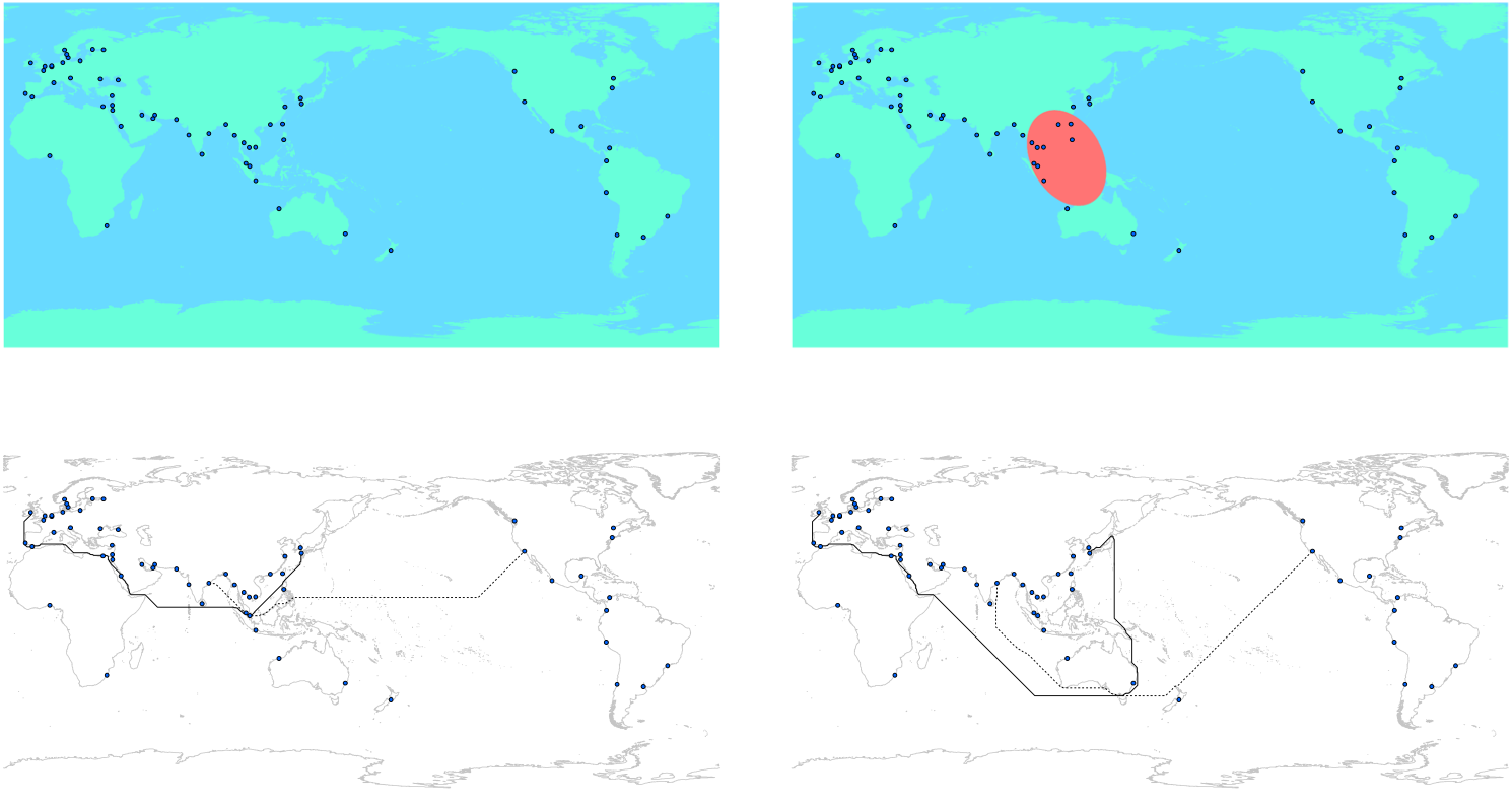
The results for a closure of the South China Sea were interesting enough to take the project further. My thesis advisor Kerem Cosar and I wrote that section up separately and it was accepted for publication as a journal article in the Review of World Economics in January 2021. Motivated by the historically tense geopolitical situation in Southeast Asia, we follow the same methodology described above to simulate the potential closure of key maritime waterways in the region to predict the impact on trade and welfare (real per capita GDP). We generate initial (unobstructed) and counterfactual (rerouted) least-cost maritime paths between trading countries, and use the distances of these routes in a workhorse model of international trade to estimate welfare effects. We find heterogeneous and economically significant reductions in real GDP, and show the magnitude of welfare loss is directly correlated with military spending as a proportion of GDP, suggesting nations may be responding to economic security threats posed by such potential conflicts.
- The Economic Benefit of the Freedom of the Seas (pdf)
- The Geopolitics of International Trade in Southeast Asia (pdf)
- Published in the Review of World Economics, February 2021, Vol.157(1) (journal link)
- NBER WP 28048
- CEPR DP 15414
- Featured in VoxEU
- Featured in The National Interest
- Cited by the Congressional Research Service